
Register of Relevant Lands
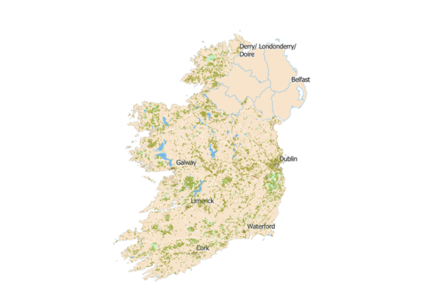
The Register of Relevant Lands is a public webmap showing all relevant public lands.
It is requirement of the LDA Act 2021 that the Agency establish and maintain a register of all relevant public land and land owned by the agency or a subsidiary DAC, to be known as the Register of Relevant Public Lands. (The Register).
- Relevant public land is defined in the LDA Act, as all land within a census town owned by a relevant public body. A census town is any urban area with a population over 10,000 accurate to the latest census information.
- A relevant public body is defined in the LDA Act to include Schedule 1 bodies - non-commercial public bodies / agencies and government departments; Schedule 2 bodies - commercial public bodies / agencies; and Local Authorities.
The Purpose of the Register
Shows the extent of all relevant Public Land, it identifies relevant public land and land owned by the agency and provides a description of the land including location on a map
Shows whether the land will be subject to Part (9) Section 75 (1) of the LDA Act, affordability requirements in relation to the development of dwellings on relevant public land or former relevant public lands or whether it has been exempted from the provisions of Part (9) S75(2).
This is the first time such a map has been developed with a purpose of showing all relevant public land. Benefits include:
the use as a strategic mapping tool that supports land management;
building an understanding of the extent and locations of public lands;
support spatial planning and urban rejuvenation
enhancing transparency regarding public lands interests.
Relevant Public lands is a definition which applies broadly to public lands in large towns and cities. Such lands are important assets, many are already developed, or used for different purposes, and perform important functions.
The Register will support the LDA’s remit to identify and assess the potential for certain public lands to be better utilised for the development of housing and other development into the future.
For further information please see our FAQ’s below.
This is a tool to support making better use of certain relevant public land
Some areas or parts of public lands may have potential to be better utilised in the public interest. For example, certain areas may be suitable for future development for housing. In such cases, where planning permission is proposed for residential use (for 5 or more homes), this could be subject to the affordability requirement.
Find more information on the affordability requirement you can read the act here.
Story Map
This story map has been created to outline the steps taken in the development of the Register, and includes an explanation of the legislation and the aims for the register.
Maintaining and updating the Register
The Register will be maintained and updated by the LDA on an ongoing basis to seek to ensure that it is up to date and accurate. Updates will take account of information from public bodies on entries/ records provided, and as new publicly owned sites are registered.
The LDA welcome feedback from Relevant Public Bodies in relation to entries shown on the register.
Feedback should include notification of any errors or a change in circumstances that is likely to have a bearing on the accuracy of the Register. Please notify the LDA using the “Give Feedback” facility within the webmap.
FAQ
The Register of Relevant Lands is a public webmap showing all relevant public lands.
- Relevant public land is defined in the LDA Act, as all land within a census town owned by a relevant public body. A census town is any urban area with a population over 10,000 accurate to the latest census information.
- A relevant public body is defined in the LDA Act to include Schedule 1 bodies - non-commercial public bodies / agencies and government departments; Schedule 2 bodies - commercial public bodies / agencies; and Local Authorities.
The Register will serve as a strategic mapping tool that shows the extent of relevant public lands. This will build understanding regarding the extent and locations of public lands, support spatial planning and urban rejuvenation as well as enhancing transparency regarding public lands interests.
It is requirement of the LDA Act 2021 that the Agency establish and maintain a register of all relevant public land and land owned by the agency or a subsidiary DAC, to be known as the Register of Relevant Public Lands. (The Register).
Relevant Public Land is defined, in the Land Development Agency Act, as all land within a census town owned by a relevant public body. A census town is any urban area with a population over 10,000 accurate to the latest census information.
A relevant public body is a body identified within the LDA Act as follows:
- Schedule 1 bodies - non-commercial public bodies / agencies and government departments.
- Schedule 2 bodies - commercial public bodies / agencies; and
- Local Authorities
The LDA Act can be read here. Section 50 of the LDA Act details the requirements for the Register.
The Register is a public webmap which shows all relevant public lands: The Register
- Shows the extent of all relevant Public Land, it identifies relevant public land and land owned by the agency and provides a description of the land including location on a map
- Shows whether the land will be subject to Part (9) Section 75 (1) of the LDA Act, affordability requirements in relation to the development of dwellings on relevant public land or former relevant public lands or whether it has been exempted from the provisions of Part (9) S75(2).
The Register is a strategic mapping tool that shows the full extent of public lands. This includes lands and buildings in public ownership due to the public ownership and location in towns over 10,000 population and cities. The definition applies broadly to public lands in large urban areas irrespective of their use or function.
Such lands are important assets, many are already developed, or used for different purposes, and perform important functions in different ways.
The definition is broad, and may include homes, schools, bus train stations, libraries and places of work etc. The Register is simply showing that these areas come within the definition of relevant public lands. The Register is not identifying any lands for development purposes.
The role of the Register on State Lands is to capture lands in state ownership under one register for a census town with a population of over 10,000.
The Register is intended to be used to support and build understanding of public lands and their potential to support with implementing Government’s affordability requirements for future development of certain relevant public lands.
The Register will assist the Agency and Government in managing state land.
The Register serves as a strategic mapping tool which is being used by the Agency to identify, assess and report (separate process to follow) to Government on the potential for certain public lands to be better utilised for housing and other developments into the future. The identification of areas with potential for future development is via a separate process. (see FAQ Report on Relevant Public Land).
Relevant Public lands is defined by the LDA Act 2021 and applies broadly to public lands in large towns (10,000 population plus) and cities, due to their public ownership (relevant public bodies) and location.
Such lands are important assets, many are already developed, or used for different purposes, and perform important functions in different ways.
Lands identified as relevant public land does not necessarily impact the current use or function. It is expected that Part 9 Affordability requirements will apply in circumstances where certain lands are identified and assessed by the LDA as relevant public land for the purpose of affordable and social housing development and are included in a Report on Relevant Public Land to Government (S52 LDA Act) or where the LDA are developing the public lands or where planning permission is sought on relevant public lands for residential use/ mixed use development for greater than 5 dwellings, then these areas will be subject to the affordability requirement (Part 9 LDA Act), unless this has been exempted by Order and the Register will show which areas have been exempted.
Where Part 9 requirement is expected to apply to relevant public lands in future, there will be a significant requirement for affordable and social housing should the lands be proposed for residential development or mixed-use development for greater than 5 dwellings. This is unless the lands have been made exempt from the requirements of Part 9. A Government Circular and Regulations will issue in regarding Part 9 requirements and application.
Part 9, Section 75 of the LDA Act refers to Affordability Requirements.
The affordability clause outlines the specified percentage of the dwellings to be built on any relevant public land that shall be:
- designated and leased as cost rental dwellings or;
- transferred on completion:
- to the ownership of the planning authority, or;
- to the ownership of eligible applicants nominated by the housing authority.
This clause shall be applied to any planning application for five or more dwellings on relevant public land. Sites can be made exempt from this clause by Ministerial order under Section 75.2 of the LDA Act 2021.
The specified percentage, where this clause applies, is 80% in areas having a population of 150,000 or more (Dublin and Cork) and 50% for areas between 10,000 and 150,000 in population.
The LDA will examine the database to identify areas with potential for state-owned lands to be better utilised for future development for housing subject to a detailed process. This will inform a Report on Relevant Public Lands to the Government during 2023. The LDA is engaging with public body landowners to assess the potential of public sites for future development.
The LDA is required to assess and report on relevant public lands as set out in Section 52 of the LDA Act 2021.
The main objective of the report is to identify public lands that have potential for future sustainable development for housing and mixed uses. These are generally sites in key locations which are not being optimised or are vacant/underutilised and have potential for housing development. The aim is to report on certain lands that the LDA has assessed and considers have the potential to be developed into the future to deliver affordable and social housing and support with building the pipeline to ensure a sustainable housing land supply that supports enhanced affordability.
This report shall be submitted to the Government within one year from the commencement of the legislation (end Q1 2023) and at least every two years thereafter.
The LDA has drawn on a range of data sources to produce the Register. The Register will be constantly updated, as new State-Owned sites will be added to the webmap on a quarterly basis to ensure all data is accurate and up to date.
LDA have sourced the publicly owned sites from the Property Registration Authority. Please contact https://www.landdirect.ie/index with any questions relating to this data. The currency and accuracy of this data within the Register of Relevant Lands at the time of inspection cannot be guaranteed. Those wishing to ensure that folio boundary data is the most accurate and up to date should access this information through https://www.landdirect.ie/index.
LDA have also sourced data from myPlan, GeoDirectory, the OSi, and the CSO.
The LDA has utilised Myplan.ie to enrich each publicly owned site with information regarding the zoning of that site, as this is the only national dataset for zoning information. Any site on LDA database with no zoning information may not be up to date on Myplan.
For the most accurate information in relation to the zoning of a site, it is recommended that the most up to date adopted Development Plan be referenced for that local authority area.
Any site that is currently zoned for green open space or for amenity use (a minimum of 80% of the site zoned for open space to be included in this layer) has been highlighted and marked as such. This is to ensure that the majority of green spaces are highlighted for their importance for amenity and open space use at at a strategic as well as local level.
The zoning data has been generated by the information available in Myplan. Some sites may not have this information available and therefore some amenity spaces may not be included in this layer. Please use the ‘Feedback’ function to highlight sites that should be included in this layer.
The full register of relevant sites is viewable on the website but the ability to identify individual Local Authority homes has been restricted to respect the privacy of dwellers.
The State Lands Database is a public webmap showing all the State Lands known to the LDA.
The Property Registration Authority (PRA) are LDA’s main supplier of information relating to the State Lands ownership and LDA are working closely with the PRA to source any property s owned by a public body. Any property or lands that the LDA understands to be owned by a public body, that are not registered with the PRAI have been reviewed, located and drawn by the LDA, and included in the “State Assets Sourced by the LDA” layer. This provides an overview as to LDA’s understanding of ownership for these assets. The LDA cannot guarantee the currency or accuracy of information shown within these layers, and as such will continue to update as sources and records and registrations are progressed. If there are omissions or errors in the entries, please use the “Give Feedback” facility, within the map, for any incorrect information within this layer
Yes, you can locate a missing site and notify the LDA using the “Give Feedback” facility within the webmap.
Yes, the three State Lands Database layers are publicly available at data.gov.ie
The Register provides a good and comprehensive representation of the extent and location of lands owned by public bodies. The constraints and limitations with difficulties regarding data and ongoing land registration means that we will need to continue to update the Register to take account of information from public bodies on entries/ records provided, and as new publicly owned sites are added to the webmap.
The LDA welcome engagement and feedback from Relevant Public Bodies in relation to entries that are shown on the mapping register. Such feedback should include notification of any errors or a change in circumstances that is likely to have a bearing on the accuracy of the Register. Please notify the LDA using the “Give Feedback” facility within
If you have any comments, feedback or queries relating to the State Lands Database and its services please use the feedback facility within the Web Map or contact [email protected]. Any other queries relating to the LDA should be directed to [email protected].